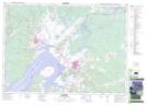
Maps showing Baie-Verte Road, New Brunswick
Baie-Verte Road is a Unincorporated area located in New Brunswick.
- Latitude: 45° 59' North (decimal: 45.9833000)
- Longitude: 64° 9' West (decimal: -64.1500000)
- Topography Feature Category: Unincorporated area
- Geographical Feature: Dispersed Rural Community
- Canadian Province/Territory: New Brunswick
- GPS Coordinate Locator Map: Baie-Verte Road Lat/Long