Maps showing Rideout Brook, Carleton, New Brunswick
Rideout Brook is a River located in Carleton, New Brunswick and has an elevation of 341 meters.
- Latitude: 46° 29' 7'' North (decimal: 46.4851849)
- Longitude: 67° 18' 13'' West (decimal: -67.303709)
- Topography Feature Category: River
- Geographical Feature: Brook
- Canadian Province/Territory: New Brunswick
- Elevation: 341 meters
- Location: Carleton
- Atlas of Canada Locator Map: Rideout Brook
- GPS Coordinate Locator Map: Rideout Brook Lat/Long
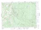
Rideout Brook NTS Map Sheets