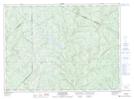
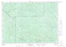
Maps showing Right Hand Branch Belone Brook, Madawaska, New Brunswick
Right Hand Branch Belone Brook is a River located in Madawaska, New Brunswick and has an elevation of 308 meters.
- Latitude: 47° 41' 20'' North (decimal: 47.6887631)
- Longitude: 68° 14' 59'' West (decimal: -68.2498554)
- Topography Feature Category: River
- Geographical Feature: Branch
- Canadian Province/Territory: New Brunswick
- Elevation: 308 meters
- Location: Madawaska
- Atlas of Canada Locator Map: Right Hand Branch Belone Brook
- GPS Coordinate Locator Map: Right Hand Branch Belone Brook Lat/Long
Right Hand Branch Belone Brook NTS Map Sheets