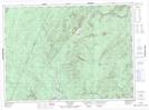
Maps showing Right Hand Branch Burntland Brook, Victoria, New Brunswick
Right Hand Branch Burntland Brook is a River located in Victoria, New Brunswick and has an elevation of 173 meters.
- Latitude: 47° 2' 17'' North (decimal: 47.0379558)
- Longitude: 67° 21' 2'' West (decimal: -67.3506598)
- Topography Feature Category: River
- Geographical Feature: Branch
- Canadian Province/Territory: New Brunswick
- Elevation: 173 meters
- Location: Victoria
- Atlas of Canada Locator Map: Right Hand Branch Burntland Brook
- GPS Coordinate Locator Map: Right Hand Branch Burntland Brook Lat/Long
Right Hand Branch Burntland Brook NTS Map Sheets