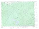
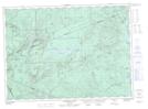
Maps showing Right Hand Branch Mamozekel River, Northumberland, New Brunswick
Right Hand Branch Mamozekel River is a River located in Northumberland, New Brunswick and has an elevation of 244 meters.
- Latitude: 47° 20' 43'' North (decimal: 47.3453647)
- Longitude: 67° 0' 20'' West (decimal: -67.0056152)
- Topography Feature Category: River
- Geographical Feature: Branch
- Canadian Province/Territory: New Brunswick
- Elevation: 244 meters
- Location: Northumberland
- Atlas of Canada Locator Map: Right Hand Branch Mamozekel River
- GPS Coordinate Locator Map: Right Hand Branch Mamozekel River Lat/Long
Right Hand Branch Mamozekel River NTS Map Sheets