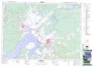
Maps showing Goose Creek, Westmorland, New Brunswick
Goose Creek is a River located in Westmorland, New Brunswick and has an elevation of 8 meters.
- Latitude: 45° 56' 1'' North (decimal: 45.9334750)
- Longitude: 64° 19' 34'' West (decimal: -64.3260394)
- Topography Feature Category: River
- Geographical Feature: Creek
- Canadian Province/Territory: New Brunswick
- Elevation: 8 meters
- Location: Westmorland
- Atlas of Canada Locator Map: Goose Creek
- GPS Coordinate Locator Map: Goose Creek Lat/Long