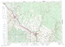
Maps showing Grand Falls Station, Madawaska, New Brunswick
Grand Falls Station is a Unincorporated area located in Madawaska, New Brunswick and has an elevation of 181 meters.
- Latitude: 47° 3' 48'' North (decimal: 47.0633539)
- Longitude: 67° 44' 41'' West (decimal: -67.7446802)
- Topography Feature Category: Unincorporated area
- Geographical Feature: Railway Point
- Canadian Province/Territory: New Brunswick
- Elevation: 181 meters
- Location: Madawaska
- Atlas of Canada Locator Map: Grand Falls Station
- GPS Coordinate Locator Map: Grand Falls Station Lat/Long
Grand Falls Station NTS Map Sheets