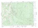
Maps showing Spruce Knoll, Carleton, New Brunswick
Spruce Knoll is a Mountain located in Carleton, New Brunswick and has an elevation of 401 meters.
- Latitude: 46° 23' 42'' North (decimal: 46.3950337)
- Longitude: 67° 11' 26'' West (decimal: -67.1904377)
- Topography Feature Category: Mountain
- Geographical Feature: Knoll
- Canadian Province/Territory: New Brunswick
- Elevation: 401 meters
- Location: Carleton
- Atlas of Canada Locator Map: Spruce Knoll
- GPS Coordinate Locator Map: Spruce Knoll Lat/Long
Spruce Knoll NTS Map Sheets