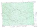
Maps showing Morrison Brook, Northumberland, New Brunswick
Morrison Brook is a River located in Northumberland, New Brunswick and has an elevation of 314 meters.
- Latitude: 46° 52' 39'' North (decimal: 46.8774621)
- Longitude: 66° 26' 25'' West (decimal: -66.4403388)
- Topography Feature Category: River
- Geographical Feature: Brook
- Canadian Province/Territory: New Brunswick
- Elevation: 314 meters
- Location: Northumberland
- Atlas of Canada Locator Map: Morrison Brook
- GPS Coordinate Locator Map: Morrison Brook Lat/Long
Morrison Brook NTS Map Sheets