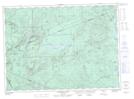
Maps showing Mount Matthew, Northumberland, New Brunswick
Mount Matthew is a Mountain located in Northumberland, New Brunswick and has an elevation of 427 meters.
- Latitude: 47° 21' 43'' North (decimal: 47.3618549)
- Longitude: 66° 58' 8'' West (decimal: -66.9689968)
- Topography Feature Category: Mountain
- Geographical Feature: Mount
- Canadian Province/Territory: New Brunswick
- Elevation: 427 meters
- Location: Northumberland
- Atlas of Canada Locator Map: Mount Matthew
- GPS Coordinate Locator Map: Mount Matthew Lat/Long
Mount Matthew NTS Map Sheets