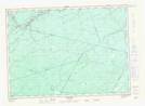
Maps showing McCarty Island, Northumberland, New Brunswick
McCarty Island is a Island located in Northumberland, New Brunswick and has an elevation of 69 meters.
- Latitude: 46° 28' 48'' North (decimal: 46.4800389)
- Longitude: 66° 23' 47'' West (decimal: -66.3964361)
- Topography Feature Category: Island
- Geographical Feature: Island
- Canadian Province/Territory: New Brunswick
- Elevation: 69 meters
- Location: Northumberland
- Atlas of Canada Locator Map: McCarty Island
- GPS Coordinate Locator Map: McCarty Island Lat/Long
McCarty Island NTS Map Sheets