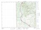
Maps showing Dougherty Brook, Victoria, New Brunswick
Dougherty Brook is a River located in Victoria, New Brunswick and has an elevation of 200 meters.
- Latitude: 46° 43' 53'' North (decimal: 46.7314751)
- Longitude: 67° 36' 49'' West (decimal: -67.6135235)
- Topography Feature Category: River
- Geographical Feature: Brook
- Canadian Province/Territory: New Brunswick
- Elevation: 200 meters
- Location: Victoria
- Atlas of Canada Locator Map: Dougherty Brook
- GPS Coordinate Locator Map: Dougherty Brook Lat/Long
Dougherty Brook NTS Map Sheets