Maps showing Douglasfield, Northumberland, New Brunswick
Douglasfield is a Unincorporated area located in Northumberland, New Brunswick and has an elevation of 32 meters.
- Latitude: 46° 59' 44'' North (decimal: 46.9955883)
- Longitude: 65° 29' 27'' West (decimal: -65.4907735)
- Topography Feature Category: Unincorporated area
- Geographical Feature: Urban Community
- Canadian Province/Territory: New Brunswick
- Elevation: 32 meters
- Location: Northumberland
- Atlas of Canada Locator Map: Douglasfield
- GPS Coordinate Locator Map: Douglasfield Lat/Long
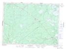
Douglasfield NTS Map Sheets