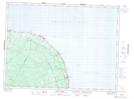
Maps showing Doyles Meadow, Restigouche, New Brunswick
Doyles Meadow is a Low vegetation located in Restigouche, New Brunswick and has an elevation of 177 meters.
- Latitude: 47° 48' 35'' North (decimal: 47.8096234)
- Longitude: 66° 0' 7'' West (decimal: -66.0018921)
- Topography Feature Category: Low vegetation
- Geographical Feature: Meadow
- Canadian Province/Territory: New Brunswick
- Elevation: 177 meters
- Location: Restigouche
- Atlas of Canada Locator Map: Doyles Meadow
- GPS Coordinate Locator Map: Doyles Meadow Lat/Long
Doyles Meadow NTS Map Sheets