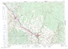
Maps showing Drummond, Victoria, New Brunswick
Drummond is a Village located in Victoria, New Brunswick and has an elevation of 217 meters.
- Latitude: 47° 2' 7'' North (decimal: 47.0353959)
- Longitude: 67° 40' 56'' West (decimal: -67.6823277)
- Topography Feature Category: Village
- Geographical Feature: Village
- Canadian Province/Territory: New Brunswick
- Elevation: 217 meters
- Location: Victoria
- Atlas of Canada Locator Map: Drummond
- GPS Coordinate Locator Map: Drummond Lat/Long
Drummond NTS Map Sheets