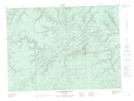
Maps showing Eighteen Mile Lake, Restigouche, New Brunswick
Eighteen Mile Lake is a Lake located in Restigouche, New Brunswick and has an elevation of 287 meters.
- Latitude: 47° 40' 48'' North (decimal: 47.6799402)
- Longitude: 66° 54' 2'' West (decimal: -66.9005165)
- Topography Feature Category: Lake
- Geographical Feature: Lake
- Canadian Province/Territory: New Brunswick
- Elevation: 287 meters
- Location: Restigouche
- Atlas of Canada Locator Map: Eighteen Mile Lake
- GPS Coordinate Locator Map: Eighteen Mile Lake Lat/Long
Eighteen Mile Lake NTS Map Sheets