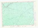
Maps showing Sand Plum Bar, Northumberland, New Brunswick
Sand Plum Bar is a Beach located in Northumberland, New Brunswick and has an elevation of 69 meters.
- Latitude: 46° 29' 9'' North (decimal: 46.4858182)
- Longitude: 66° 21' 56'' West (decimal: -66.3654622)
- Topography Feature Category: Beach
- Geographical Feature: Bar
- Canadian Province/Territory: New Brunswick
- Elevation: 69 meters
- Location: Northumberland
- Atlas of Canada Locator Map: Sand Plum Bar
- GPS Coordinate Locator Map: Sand Plum Bar Lat/Long
Sand Plum Bar NTS Map Sheets