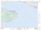
Maps showing Cape Marsh, Westmorland, New Brunswick
Cape Marsh is a Low vegetation located in Westmorland, New Brunswick and has an elevation of 1 meters.
- Latitude: 46° 8' 53'' North (decimal: 46.1480120)
- Longitude: 63° 49' 18'' West (decimal: -63.8216976)
- Topography Feature Category: Low vegetation
- Geographical Feature: Marsh
- Canadian Province/Territory: New Brunswick
- Elevation: 1 meters
- Location: Westmorland
- Atlas of Canada Locator Map: Cape Marsh
- GPS Coordinate Locator Map: Cape Marsh Lat/Long
Cape Marsh NTS Map Sheets