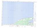
Maps showing Petite rivière Caraquet, Gloucester, New Brunswick
Petite rivière Caraquet is a River located in Gloucester, New Brunswick and has an elevation of 11 meters.
- Latitude: 47° 46' 1'' North (decimal: 47.7670679)
- Longitude: 64° 59' 43'' West (decimal: -64.9952026)
- Topography Feature Category: River
- Geographical Feature: Rivière
- Canadian Province/Territory: New Brunswick
- Elevation: 11 meters
- Location: Gloucester
- Atlas of Canada Locator Map: Petite rivière Caraquet
- GPS Coordinate Locator Map: Petite rivière Caraquet Lat/Long
Petite rivière Caraquet NTS Map Sheets