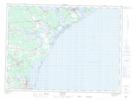
Maps showing Baie aux Caribous, Gloucester, New Brunswick
Baie aux Caribous is a Bay located in Gloucester, New Brunswick and has an elevation of 2 meters.
- Latitude: 47° 44' 27'' North (decimal: 47.7407520)
- Longitude: 64° 39' 20'' West (decimal: -64.6556645)
- Topography Feature Category: Bay
- Geographical Feature: Baie
- Canadian Province/Territory: New Brunswick
- Elevation: 2 meters
- Location: Gloucester
- Atlas of Canada Locator Map: Baie aux Caribous
- GPS Coordinate Locator Map: Baie aux Caribous Lat/Long