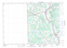
Maps showing Carlisle Lakes, Carleton, New Brunswick
Carlisle Lakes is a Lake located in Carleton, New Brunswick and has an elevation of 172 meters.
- Latitude: 46° 29' 50'' North (decimal: 46.4972866)
- Longitude: 67° 43' 40'' West (decimal: -67.7278489)
- Topography Feature Category: Lake
- Geographical Feature: Lakes
- Canadian Province/Territory: New Brunswick
- Elevation: 172 meters
- Location: Carleton
- Atlas of Canada Locator Map: Carlisle Lakes
- GPS Coordinate Locator Map: Carlisle Lakes Lat/Long
Carlisle Lakes NTS Map Sheets