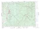
Maps showing Banks of Padou Bogan, Victoria, New Brunswick
Banks of Padou Bogan is a River feature located in Victoria, New Brunswick and has an elevation of 137 meters.
- Latitude: 46° 59' 16'' North (decimal: 46.9876879)
- Longitude: 67° 19' 9'' West (decimal: -67.3191459)
- Topography Feature Category: River feature
- Geographical Feature: Bogan
- Canadian Province/Territory: New Brunswick
- Elevation: 137 meters
- Location: Victoria
- Atlas of Canada Locator Map: Banks of Padou Bogan
- GPS Coordinate Locator Map: Banks of Padou Bogan Lat/Long
Banks of Padou Bogan NTS Map Sheets