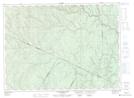
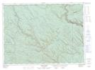
Maps showing Falls Brook, New Brunswick
Falls Brook is a River located in New Brunswick.
- Latitude: 47° 41' North (decimal: 47.6833000)
- Longitude: 67° 48' West (decimal: -67.7999999)
- Topography Feature Category: River
- Geographical Feature: Brook
- Canadian Province/Territory: New Brunswick
- GPS Coordinate Locator Map: Falls Brook Lat/Long
Falls Brook NTS Map Sheets