Canada Topographic Maps

Bouleaux Point Topo Maps

Topography maps and Latitude/Longitude Location

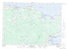
Maps showing Bouleaux Point, New Brunswick

Bouleaux Point is a Cape located in New Brunswick.

  • Latitude: 46° 14' North   (decimal: 46.2333000)
  • Longitude: 64° 25' West   (decimal: -64.4167000)
  • Topography Feature Category: Cape
  • Geographical Feature: Point
  • Canadian Province/Territory: New Brunswick
  • GPS Coordinate Locator Map: Bouleaux Point Lat/Long

Bouleaux Point NTS Map Sheets

021I01 Port Elgin Topographic Map at 1:50,000 scale

021I Moncton Topographic Map at 1:250,000 scale

 
Buy Topographic Maps DVD
Newsletter Sign-up

Yes, I want to receive map store discounts.


Bookmark and Share