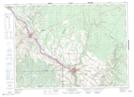
Maps showing Upper Siegas, New Brunswick
Upper Siegas is a Unincorporated area located in New Brunswick.
- Latitude: 47° 15' North (decimal: 47.2499999)
- Longitude: 67° 56' West (decimal: -67.9332999)
- Topography Feature Category: Unincorporated area
- Geographical Feature: Dispersed Rural Community
- Canadian Province/Territory: New Brunswick
- GPS Coordinate Locator Map: Upper Siegas Lat/Long
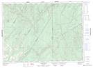
Upper Siegas NTS Map Sheets