Maps showing Ruisseau à Charbon, Madawaska, New Brunswick
Ruisseau à Charbon is a River located in Madawaska, New Brunswick and has an elevation of 217 meters.
- Latitude: 47° 15' 5'' North (decimal: 47.251404)
- Longitude: 68° 43' 44'' West (decimal: -68.7288160)
- Topography Feature Category: River
- Geographical Feature: Ruisseau
- Canadian Province/Territory: New Brunswick
- Elevation: 217 meters
- Location: Madawaska
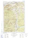
- Atlas of Canada Locator Map: Ruisseau à Charbon
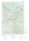
- GPS Coordinate Locator Map: Ruisseau à Charbon Lat/Long
Ruisseau à Charbon NTS Map Sheets