Maps showing Northesk, Northumberland, New Brunswick
Northesk is a Geographical area located in Northumberland, New Brunswick and has an elevation of 387 meters.
- Latitude: 47° 15' 1'' North (decimal: 47.2501726)
- Longitude: 66° 15' 00'' West (decimal: -66.2499506)
- Topography Feature Category: Geographical area
- Geographical Feature: Parish
- Canadian Province/Territory: New Brunswick
- Elevation: 387 meters
- Location: Northumberland
- Atlas of Canada Locator Map: Northesk
- GPS Coordinate Locator Map: Northesk Lat/Long
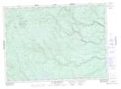
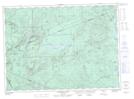
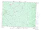
Northesk NTS Map Sheets
021I13 Newcastle Topographic Map at 1:50,000 scale
021O01 Big Bald Mountain Topographic Map at 1:50,000 scale
021O02 Serpentine Lake Topographic Map at 1:50,000 scale
021O07 Nepisiguit Lakes Topographic Map at 1:50,000 scale
021O08 California Lake Topographic Map at 1:50,000 scale
021P04 Sevogle Topographic Map at 1:50,000 scale
021P05 Nepisiguit Falls Topographic Map at 1:50,000 scale
021I Moncton Topographic Map at 1:250,000 scale
021O Campbellton Topographic Map at 1:250,000 scale
021P Bathurst Topographic Map at 1:250,000 scale