Canada Topographic Maps

Albert Topo Maps

Topography maps and Latitude/Longitude Location

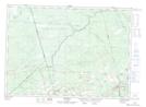
Maps showing Albert, New Brunswick

Albert is a Geographical area located in New Brunswick.

  • Latitude: 45° 50' North   (decimal: 45.8332999)
  • Longitude: 64° 55' West   (decimal: -64.9167000)
  • Topography Feature Category: Geographical area
  • Geographical Feature: County
  • Canadian Province/Territory: New Brunswick
  • Atlas of Canada Locator Map: Albert
  • GPS Coordinate Locator Map: Albert Lat/Long

Albert NTS Map Sheets

021H10 Alma Topographic Map at 1:50,000 scale

021H11 Waterford Topographic Map at 1:50,000 scale

021H14 Petitcodiac Topographic Map at 1:50,000 scale

021H15 Hillsborough Topographic Map at 1:50,000 scale

021I02 Moncton Topographic Map at 1:50,000 scale

021I03 Salisbury Topographic Map at 1:50,000 scale

021H Amherst Topographic Map at 1:250,000 scale

021I Moncton Topographic Map at 1:250,000 scale

 
Buy Topographic Maps DVD
Newsletter Sign-up

Yes, I want to receive map store discounts.


Bookmark and Share