Maps showing Middle Landing, Gloucester, New Brunswick
Middle Landing is a Unincorporated area located in Gloucester, New Brunswick and has an elevation of 62 meters.
- Latitude: 47° 26' 31'' North (decimal: 47.4419350)
- Longitude: 65° 42' 30'' West (decimal: -65.7084358)
- Topography Feature Category: Unincorporated area
- Geographical Feature: Landing
- Canadian Province/Territory: New Brunswick
- Elevation: 62 meters
- Location: Gloucester
- Atlas of Canada Locator Map: Middle Landing
- GPS Coordinate Locator Map: Middle Landing Lat/Long
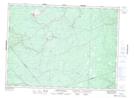
Middle Landing NTS Map Sheets