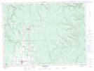
Maps showing Ruisseau Donat-Albert, Restigouche, New Brunswick
Ruisseau Donat-Albert is a River located in Restigouche, New Brunswick and has an elevation of 260 meters.
- Latitude: 47° 33' 47'' North (decimal: 47.5631916)
- Longitude: 67° 20' 50'' West (decimal: -67.3473605)
- Topography Feature Category: River
- Geographical Feature: Ruisseau
- Canadian Province/Territory: New Brunswick
- Elevation: 260 meters
- Location: Restigouche
- Atlas of Canada Locator Map: Ruisseau Donat-Albert
- GPS Coordinate Locator Map: Ruisseau Donat-Albert Lat/Long
Ruisseau Donat-Albert NTS Map Sheets