Canada Topographic Maps

Rivière du Vin Topo Maps

Topography maps and Latitude/Longitude Location

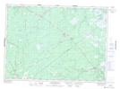
Maps showing Rivière du Vin, New Brunswick

Rivière du Vin is a River located in New Brunswick.

  • Latitude: 47° 3' North   (decimal: 47.0499999)
  • Longitude: 65° 8' West   (decimal: -65.1332999)
  • Topography Feature Category: River
  • Geographical Feature: Rivière
  • Canadian Province/Territory: New Brunswick
  • GPS Coordinate Locator Map: Rivière du Vin Lat/Long

Rivière du Vin NTS Map Sheets

021I14 Kouchibouguac Topographic Map at 1:50,000 scale

021P03 Chatham Topographic Map at 1:50,000 scale

021I Moncton Topographic Map at 1:250,000 scale

021P Bathurst Topographic Map at 1:250,000 scale

 
Buy Topographic Maps DVD
Newsletter Sign-up

Yes, I want to receive map store discounts.


Bookmark and Share