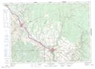
Maps showing Saint-Léonard, New Brunswick
Saint-Léonard is a Town located in New Brunswick.
- Latitude: 47° 9' 45'' North (decimal: 47.1624998)
- Longitude: 67° 55' 30'' West (decimal: -67.9249998)
- Topography Feature Category: Town
- Geographical Feature: Town
- Canadian Province/Territory: New Brunswick
- Atlas of Canada Locator Map: Saint-Léonard
- GPS Coordinate Locator Map: Saint-Léonard Lat/Long
Saint-Léonard NTS Map Sheets