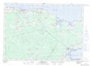
Maps showing Cap-Pele, Westmorland; Shediac, New Brunswick
Cap-Pele is a Village located in Westmorland; Shediac, New Brunswick and has an elevation of 15 meters.
- Latitude: 46° 12' 56'' North (decimal: 46.2155462)
- Longitude: 64° 16' 22'' West (decimal: -64.2728762)
- Topography Feature Category: Village
- Geographical Feature: Village
- Canadian Province/Territory: New Brunswick
- Elevation: 15 meters
- Location: Westmorland; Shediac
- Atlas of Canada Locator Map: Cap-Pele
- GPS Coordinate Locator Map: Cap-Pele Lat/Long