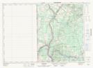
Maps showing Ancienne église unie St. James, Victoria, New Brunswick
Ancienne église unie St. James is a Conservation area located in Victoria, New Brunswick.
- Latitude: 46° 45' 10'' North (decimal: 46.7527999)
- Longitude: 67° 42' 15'' West (decimal: -67.7042000)
- Topography Feature Category: Conservation area
- Geographical Feature: Lieu historique provincial
- Canadian Province/Territory: New Brunswick
- Location: Victoria
- Atlas of Canada Locator Map: Ancienne église unie St. James
- GPS Coordinate Locator Map: Ancienne église unie St. James Lat/Long
Ancienne église unie St. James NTS Map Sheets