Maps showing Église anglicane Saint John the Baptist, Madawaska, New Brunswick
Église anglicane Saint John the Baptist is a Conservation area located in Madawaska, New Brunswick.
- Latitude: 47° 21' 50'' North (decimal: 47.363889)
- Longitude: 68° 19' 50'' West (decimal: -68.330556)
- Topography Feature Category: Conservation area
- Geographical Feature: Lieu historique provincial
- Canadian Province/Territory: New Brunswick
- Location: Madawaska
- Atlas of Canada Locator Map: Église anglicane Saint John the Baptist
- GPS Coordinate Locator Map: Église anglicane Saint John the Baptist Lat/Long
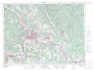
Église anglicane Saint John the Baptist NTS Map Sheets