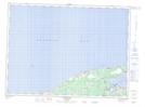
Maps showing Village historique acadien, Gloucester, New Brunswick
Village historique acadien is a Conservation area located in Gloucester, New Brunswick.
- Latitude: 47° 47' 26'' North (decimal: 47.7906000)
- Longitude: 65° 9' 49'' West (decimal: -65.1635999)
- Topography Feature Category: Conservation area
- Geographical Feature: Village historique provincial
- Canadian Province/Territory: New Brunswick
- Location: Gloucester
- Atlas of Canada Locator Map: Village historique acadien
- GPS Coordinate Locator Map: Village historique acadien Lat/Long
Village historique acadien NTS Map Sheets