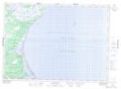
Maps showing Pointe-Sapin Provincial Park, Kent, New Brunswick
Pointe-Sapin Provincial Park is a Conservation area located in Kent, New Brunswick.
- Latitude: 46° 58' North (decimal: 46.9667000)
- Longitude: 64° 50' West (decimal: -64.8333000)
- Topography Feature Category: Conservation area
- Geographical Feature: Provincial Park
- Canadian Province/Territory: New Brunswick
- Location: Kent
- Atlas of Canada Locator Map: Pointe-Sapin Provincial Park
- GPS Coordinate Locator Map: Pointe-Sapin Provincial Park Lat/Long
Pointe-Sapin Provincial Park NTS Map Sheets