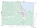
Maps showing Pabineau 11, Gloucester, New Brunswick
Pabineau 11 is a Indian Reserve located in Gloucester, New Brunswick.
- Latitude: 47° 32' 7'' North (decimal: 47.5352777)
- Longitude: 65° 39' 53'' West (decimal: -65.6647222)
- Topography Feature Category: Indian Reserve
- Geographical Feature: Indian Reserve - Réserve indienne
- Canadian Province/Territory: New Brunswick
- Location: Gloucester
- Atlas of Canada Locator Map: Pabineau 11
- GPS Coordinate Locator Map: Pabineau 11 Lat/Long