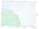
Maps showing Rivière aux Ormes, Gloucester, New Brunswick
Rivière aux Ormes is a River located in Gloucester, New Brunswick.
- Latitude: 47° 48' North (decimal: 47.8)
- Longitude: 65° 44' West (decimal: -65.7333328)
- Topography Feature Category: River
- Geographical Feature: Rivière
- Canadian Province/Territory: New Brunswick
- Location: Gloucester
- Atlas of Canada Locator Map: Rivière aux Ormes
- GPS Coordinate Locator Map: Rivière aux Ormes Lat/Long
Rivière aux Ormes NTS Map Sheets