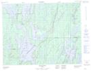
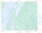
Maps showing Baie Abatagouche, Baie-James; Jamésie, Quebec
Baie Abatagouche is a Bay located in Baie-James; Jamésie, Quebec and has an elevation of 392 meters.
- Latitude: 50° 33' 58'' North (decimal: 50.5661815)
- Longitude: 73° 50' 6'' West (decimal: -73.8348631)
- Topography Feature Category: Bay
- Geographical Feature: Baie
- Canadian Province/Territory: Quebec
- Elevation: 392 meters
- Location: Baie-James; Jamésie
- Atlas of Canada Locator Map: Baie Abatagouche
- GPS Coordinate Locator Map: Baie Abatagouche Lat/Long
Baie Abatagouche NTS Map Sheets