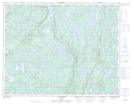
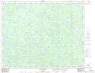
Maps showing Rivière de l'Abbé-Huard, Lac-Jérôme; Minganie, Quebec
Rivière de l'Abbé-Huard is a River located in Lac-Jérôme; Minganie, Quebec and has an elevation of 236 meters.
- Latitude: 50° 59' 1'' North (decimal: 50.9836111)
- Longitude: 63° 17' 23'' West (decimal: -63.2897222)
- Topography Feature Category: River
- Geographical Feature: Rivière
- Canadian Province/Territory: Quebec
- Elevation: 236 meters
- Location: Lac-Jérôme; Minganie
- Atlas of Canada Locator Map: Rivière de l'Abbé-Huard
- GPS Coordinate Locator Map: Rivière de l'Abbé-Huard Lat/Long
Rivière de l'Abbé-Huard NTS Map Sheets