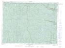
Maps showing Lac de l'Aboutis, Lac-Pikauba; Charlevoix, Quebec
Lac de l'Aboutis is a Lake located in Lac-Pikauba; Charlevoix, Quebec.
- Latitude: 47° 56' 5'' North (decimal: 47.9347491)
- Longitude: 70° 32' 23'' West (decimal: -70.5397985)
- Topography Feature Category: Lake
- Geographical Feature: Lac
- Canadian Province/Territory: Quebec
- Location: Lac-Pikauba; Charlevoix
- GPS Coordinate Locator Map: Lac de l'Aboutis Lat/Long
Lac de l'Aboutis NTS Map Sheets