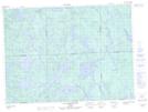
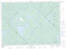
Maps showing Ruisseau Albert, Rivière-Kipawa; Témiscamingue, Quebec
Ruisseau Albert is a River located in Rivière-Kipawa; Témiscamingue, Quebec and has an elevation of 315 meters.
- Latitude: 47° 13' 46'' North (decimal: 47.2295118)
- Longitude: 78° 37' 30'' West (decimal: -78.6250757)
- Topography Feature Category: River
- Geographical Feature: Ruisseau
- Canadian Province/Territory: Quebec
- Elevation: 315 meters
- Location: Rivière-Kipawa; Témiscamingue
- Atlas of Canada Locator Map: Ruisseau Albert
- GPS Coordinate Locator Map: Ruisseau Albert Lat/Long
Ruisseau Albert NTS Map Sheets