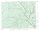
Maps showing Ruisseau Albert-Gendron, Routhierville; La Matapédia, Quebec
Ruisseau Albert-Gendron is a River located in Routhierville; La Matapédia, Quebec and has an elevation of 326 meters.
- Latitude: 48° 14' 13'' North (decimal: 48.2369928)
- Longitude: 66° 58' 48'' West (decimal: -66.9799738)
- Topography Feature Category: River
- Geographical Feature: Ruisseau
- Canadian Province/Territory: Quebec
- Elevation: 326 meters
- Location: Routhierville; La Matapédia
- Atlas of Canada Locator Map: Ruisseau Albert-Gendron
- GPS Coordinate Locator Map: Ruisseau Albert-Gendron Lat/Long
Ruisseau Albert-Gendron NTS Map Sheets