Maps showing Baie Alfred, Baie-James; Jamésie, Quebec
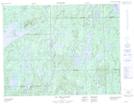
Baie Alfred is a Bay located in Baie-James; Jamésie, Quebec.
- Latitude: 50° 11' 28'' North (decimal: 50.1911111)
- Longitude: 73° 57' 30'' West (decimal: -73.9583333)
- Topography Feature Category: Bay
- Geographical Feature: Baie
- Canadian Province/Territory: Quebec
- Location: Baie-James; Jamésie
- Atlas of Canada Locator Map: Baie Alfred
- GPS Coordinate Locator Map: Baie Alfred Lat/Long
Baie Alfred NTS Map Sheets