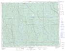
Maps showing Ally, Lac-Ashuapmushuan; Le Domaine-du-Roy, Quebec
Ally is a Unincorporated area located in Lac-Ashuapmushuan; Le Domaine-du-Roy, Quebec.
- Latitude: 48° 58' 42'' North (decimal: 48.9783333)
- Longitude: 73° 21' 3'' West (decimal: -73.3508333)
- Topography Feature Category: Unincorporated area
- Geographical Feature: Arrêt ferroviaire
- Canadian Province/Territory: Quebec
- Location: Lac-Ashuapmushuan; Le Domaine-du-Roy
- Atlas of Canada Locator Map: Ally
- GPS Coordinate Locator Map: Ally Lat/Long
Ally NTS Map Sheets