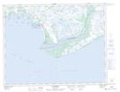
Maps showing Île aux Américains, Natashquan; Minganie, Quebec
Île aux Américains is a Island located in Natashquan; Minganie, Quebec and has an elevation of 0 meters.
- Latitude: 50° 11' 20'' North (decimal: 50.1889606)
- Longitude: 61° 51' 15'' West (decimal: -61.8542597)
- Topography Feature Category: Island
- Geographical Feature: Île / Ile
- Canadian Province/Territory: Quebec
- Elevation: 0 meters
- Location: Natashquan; Minganie
- Atlas of Canada Locator Map: Île aux Américains
- GPS Coordinate Locator Map: Île aux Américains Lat/Long
Île aux Américains NTS Map Sheets