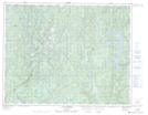
Maps showing Lac André, Lac-Jérôme; Minganie, Quebec
Lac André is a Lake located in Lac-Jérôme; Minganie, Quebec and has an elevation of 336 meters.
- Latitude: 50° 53' 23'' North (decimal: 50.8897222)
- Longitude: 63° 31' 58'' West (decimal: -63.5327778)
- Topography Feature Category: Lake
- Geographical Feature: Lac
- Canadian Province/Territory: Quebec
- Elevation: 336 meters
- Location: Lac-Jérôme; Minganie
- Atlas of Canada Locator Map: Lac André
- GPS Coordinate Locator Map: Lac André Lat/Long
Lac André NTS Map Sheets