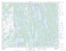
Maps showing Lac des Anges, Lac-Jérôme; Minganie, Quebec
Lac des Anges is a Lake located in Lac-Jérôme; Minganie, Quebec and has an elevation of 184 meters.
- Latitude: 50° 39' 44'' North (decimal: 50.6622900)
- Longitude: 62° 33' 56'' West (decimal: -62.5656645)
- Topography Feature Category: Lake
- Geographical Feature: Lac
- Canadian Province/Territory: Quebec
- Elevation: 184 meters
- Location: Lac-Jérôme; Minganie
- Atlas of Canada Locator Map: Lac des Anges
- GPS Coordinate Locator Map: Lac des Anges Lat/Long
Lac des Anges NTS Map Sheets