Maps showing Rivière Angle, Baie-James; Jamésie, Quebec
Rivière Angle is a River located in Baie-James; Jamésie, Quebec and has an elevation of 240 meters.
- Latitude: 49° 59' 44'' North (decimal: 49.9956435)
- Longitude: 78° 54' 8'' West (decimal: -78.9022610)
- Topography Feature Category: River
- Geographical Feature: Rivière
- Canadian Province/Territory: Quebec
- Elevation: 240 meters
- Location: Baie-James; Jamésie
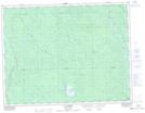
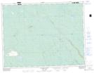
- Atlas of Canada Locator Map: Rivière Angle
- GPS Coordinate Locator Map: Rivière Angle Lat/Long
Rivière Angle NTS Map Sheets